Sunday, April 15, 2012

Crossing the Hawkesbury by Rail

Railway Bridge across the Hawkesbury River - the "old" and "new" 

Brooklyn, New South Wales, on the the Hawkesbury River is rich in history. From the time of the Aboriginal  people of the Dharug tribe, to the first visit by Captain Phillip on 7 March 1788, to the present day, it has been witness to some significant events.

The most important of course being the construction of the rail and road bridges across the Hawkesbury.  A visit to Brooklyn can reveal their history.

The Railway


The Main Northern Railway Line (single track) from Hornsby to the Hawkesbury River Station at Brooklyn was opened on 7 April 1887. In the days before the first railway bridge was completed,  a branch line along a causeway formed by reclaimed land on the eastern side of Long Island carried passengers to the River Wharf Station. Here they would transfer to the paddle-steamer, General Gordon*, for the journey to Gosford, and later Mullet Creek, to join the trains going north.


On a recent visit, we walked along this causeway, seeing a remnant wall of the platform of the River Walk Station (photo at left)  and the  foundations of the Gordon Wharf (photos below).
  Platform Wall of the River Walk Station

Foundations of the Gordon Wharf
The Union Bridge Company of New York, USA, was awarded the contract to construct the first  railway bridge across the River in 1886. The piers consisted of concrete under the water and then built to the required height by sandstone quarried at the head of Mullet Creek opposite the present quarry at Wondabyne Station. The spans were assembled on Dangar Island and floated onto the piers by punts

The bridge was opened on 1 May 1889 to much fanfare. It was the  last link in the railway network extending from South Australia to Queensland.

It served the line well but when cracks started to appear in the late 1930's, a decision was made to replace the bridge.  Construction of the second  railway bridge  by the NSW Government Railways was commenced in 1939.

The spans were bought to Brooklyn pieces and assembled over three docks that were carved into the rock at the northern end of Long Island. (Photos below). When they were ready, the spans were floated out on large barges at high tide and lowered onto the piers at low tide.
  

One of the construction docks on Long Island.......
........a close-up view.
The   second railway bridge was opened on  1 July 1946. The old bridge was removed   but its sandstone piers remain  to this day. A great view of the  new bridge and the remains of the old piers is at the head      of this blog.

Of course in  both World Wars the bridges were heavily guarded. In one of the  piers in the Photo below, you can see on close inspection that dynamite holes had been drilled in case the bridge had to be destroyed.

*****************************************************************

If you are in interested in early Australian History go to our website at:


* Interestingly In its Hotel and Liquor Licenses Database, History Services NSW has details of Packet (Nautical) Licences being granted at various periods to Alexander Sinclair Murray and John Finlayson for the General Gordon Paddle-steamer.


Monday, April 9, 2012

Boronia Park - Its Cultural Heritage

Today as a part of our Hunters Hill discovery tour we did the Boronia Park Walk, which is part of the Great North Walk.

It was a beautiful walk, descending down to the Lane Cove River and continuing along the wetlands of the mangrove swamps.

We came upon extensive areas of Aboriginal middens (some of the largest we have seen) and caves where the Wallumedegal people would have lived prior to European settlement (Photo at left above).

This area of the Lane Cove River is very accessible to the shore and so the early Aboriginal tribes would have enjoyed a prime location in which to live, just as the modern day residents of Hunters Hill do.

A little further along, we came across a Sydney Water pumping station at Thorn Street. A pipeline has been laid under the river. Even though it is a major disruption to the natural environment, the pipe is hidden beneath an embankment which forms a picturesque "avenue" through the mangrove swamps (Photo a at right above.)

On emerging back into suburbia, at the entrance to Boronia Park on the corner of Park Road and Princes Street, we noticed a horse trough (Photos below).


What is the historical significance of this?


It is a Bills horse trough , one of many watering troughs that were manufactured in Australia and installed at various locations for the relief of working horses in the first half of the twentieth century. They were funded from a special trust set up by George Bills and his wife Annis.


An interesting day!
*************************************************

If you are in interested in early Australian History go to our website at:

Wednesday, March 28, 2012

The Hotels of Woolloomooloo

Woolloomooloo is a harbourside, inner-city eastern suburb of Sydney. It has always played a colourful part in Sydney's housing heritage. From the working class cottages of the 1850s, to the 'boom style' Victorian terraces of the 1880s, to the public housing developments of 1970s and now to the gentrification of the waterfront areas particularly the housing development on the Finger Wharf.

To servcie the thirst of the residents of the times, a large number of hotels were established. A walk through Woolloomooloo reveals a legacy of these hotels.

In its Hotel and Liquor Licenses Database, History Services NSW has details of the licensees of the various hotels in Woolloomooloo for the period from 1860 to 1900. We photographed the following establishments on our recent walk through the area:

95 Forbes Street (c 1865.) The first two storeys were built as the President Lincoln Hotel, now used as office space.

Details held on licensees for the President Lincoln Hotel for the period 1867 to 1900.


70 Forbes Street. Built around 1865 as Bottomley's Hotel and has now been converted to a house.

Details held on licensees for the Bottomley's Family Hotel for the period 1865 to 1884; and for
Bottomley's Hotel for the period 1885 to 1900


52-66 Forbes Street c 1885. This row is known as Bottomley's Terrace and was built on the site of the Royal Yacht Hotel.

Details held on licensees for the Yacht Hotel 1865-66, 1868 to 1873; and for the Royal Yacht Hotel 1867, 1864 to 1877, 1879 to 1880.

The houses are now used as the administration block for the Plunkett Street Public School and the Sydney Distance Education High School.


Frisco Hotel, 46 Dowling Street. Built on the site of the Dowling Street Wharf Hotel which dated back to the 1860's.

Details held on licensees for the Wharf Hotel for the period for the period 1862-1890; Dowling Wharf Hotel for the period 1891 to 1893; and for the Dowling Street Wharf Hotel 1886 (Billiard License only)


Revolving Battery Hotel, 123 Dowling Street. Built on the site of an earlier hotel of the same name.

Details held on licensees of the Royal Battery Hotel for the period 1865 to 1900.


The Tilbury Hotel. Formerly the Cowper Wharf Hotel built on the site of an inn dating back to 1860's.


Details held on the licensees for the Cowper Wharf Hotel for the period 1876 to 1900.


36 Forbes Street (1885). Built originally as the Eastern Market Hotel, now residential.

Details held on licensees for the Eastern Markets Hotel for the period 1872 to 1900.


98 Bourke Street. Originally the Dewdrop Hotel.

Details held on licensees for the Dew Drop for the period 1865 to 1871.


Macquarie Hotel. Built on the site of the Nell Gwynne Hotel.

Details held on the licensees for the Nell Gwynne Hotel for the period 1873 to 1878.


Bell's Hotel. Licensed to the famous boxer Jimmy Carruthers in the 1950s.


If you are researching the history of hotels in the Wooloomooloo area or in New South Wales generally, you should go to the website at:

Tuesday, January 31, 2012

Hunters Hill- A Closer Look

In October 2011, we did a Jacaranda Cruise as part of the celebrations of Hunters Hill Sesquicentenary of becoming a Municipality in 1861.

That day we cruised the foreshores of Hunters Hill along the Lane Cove and Parramatta Rivers. Today we did a heritage walking tour to discover up close some of the rich history of Hunters Hill.

Of particular interest were:

Vienna Cottage, the National Trust property at 38 Alexandra Street. This stone cottage built in 1871 was the home of John Jacob Hellman and his wife Ann O'Donnell and their six children. John was a shoemaker by trade and came from Hamburg in Germany. Ann, an Irish bounty migrant, came from Mooneenreave, County Leitrim, Ireland.


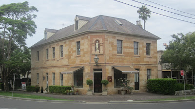
Garibaldi Hotel, on the corner of Alexandra and Ferry Streets. This was Hunters Hill first hotel built in 1861 by Italian immigrant and local businessman, John Cuneo. It was named after the Italian patriot Giuseppe Garibaldi (1807-1882) who fought for the liberation and unification of Italy. It is a golden stone building with a classical Italian sculpture in a niche above the door.

History Services NSW in its Hotel and Liquor Licenses Database has a listing of the various publicans of the Garibaldi Hotel during the period 1865-1900.

First official Post Office at 23 Alexandra Street, Hunters Hill. This was in operation between 1879-1891 when the Postmistress was Miss Twentyman.


Current Post Office, at 32 Alexandra Street, diagonally across from the original Post Office. It is a heritage building built in 1891 as designed by the government architect, Walter Liberty Vernon, in Queen Anne Style. It is listed on the Register of the National Estate.

History Services NSW in its Government Contracts and Contractors Database has details of several contracts awarded by the Department of Public Works for building and repairs relating to the Hunters Hill Post Office in 1890s.

The Priory at Tarban Creek. This site was first used as a mixed farming establishment in 1836 by Thomas Stubbs. In 1847 he sold the farm to the French missionary order of the Society of Mary (Marist Fathers). They used the farm, buildings and gardens as their first base in Australia and as a rest and recuperation facility for their missionaries stationed in the South West Pacific. In 1857 the Marists extended Stubbs original sandstone farmhouse under the architect, William Weaver. They named the site "Villa Maria"

In 1864 when the Marists moved to the opposite side of Tarban Creek, the property was purchased by Thomas Salter who built on a gothic style and renamed it The Priory.

In 1888, The Priory became part of Gladesville Hospital. The surrounding land was farmed by the patients for the production of fruit and vegetables for hospital use, and in the Second World War an air raid shelter was cut into the terrace.

Church of the Holy Name of Mary, Mary St, Hunters Hill.

The original foundation stone of the church was blessed by Archbishop John Bede Polding on 12 Septmeber 1867 and laid on the 15 September. The church which is now the centre of the Marist Fathers Headquarters in Hunters Hill, was blessed and opened by Bishop Louis Elloy SM on 12 November 1871.
Our daughter was married in this church in 2003.

Thursday, January 26, 2012

Lord Sydney and The Convict Arrow


What is the origin of the convict broad arrow that is such a familiar symbol in our convict history?

Andrew Tink in his recent book, Lord Sydney [the life and times of Tommy Townshend] (Australian Scholarly Publishing Pty Ltd 2011), explains that broad arrows (pheons) were used by Lord Sydney's ancestors, Algernon and Henry Sidney in their family coats of arms. Henry Sidney, 1st Earl of Romney, was Master-General of Ordinance (1693-1702) in charge of government supplies. He introduced the use of the broad arrow heads to mark all government property in the United Kingdom.

And so with the decision to transport convicts to New South Wales, the broad arrow was exported on convict property providing a significant, if incidental, link to Lord Sydney's family.

Congratulations to Andrew Tink for his book on Lord Sydney, providing us with a fascinating biography of the person for whom our great city of Sydney was named.

Lord Sydney was Home Secretary in the British Government at the time of the passage of the Transportation Act of 1784. He was responsible for overseeing the logistics of the venture to send convicts to Botany Bay.

Had it was not for his wise choice of Captain Arthur Phillip to command the First Fleet and for his diligent planning of the outfitting of the Fleet, our destiny may have been very different.

If you are interested in Australian history or are researching a convict ancestor, go to our web site at: http://www.historyservices.com.au/

Tuesday, January 17, 2012

Meadowbank and the Ryde Riverwalk

Today we explored Meadowbank, New South Wales on foot. Being the site of both river, road and railway crossings of the Parramatta River, this area is rich in colonial history.

Starting from the Meadowbank Wharf, we did part of the Ryde Riverwalk south along Shepherds Bay.

Immediately we came across an historical photo of the area (at left below), of a ferry leaving Ryde Wharf, circa 1910-1915. This is contrasted with the modern view of Shepherds Bay today (photo at right below) looking back towards the railway bridge.


Shepherds Bay was named after James Shepherd, a convict who arrived in the Colony in August 1791 (per the Matilda). In 1795, he married Ann Thorn who had arrived in October 1794 (per the Surprise). Both had received land grants in the vicinity of modern day Meadowbank. [See below for details of the records held by History Services NSW on James Shepherd and Ann Thorn].*

The first rowing boat service across the river was established as early as 1794 as the Shepherds Bay Row Boat ferry service from Schooners Wharf (Belmore Road, near Helene Park) to the Concord shore. The three wind vane "boats" at the Ryde Wharf Reserve theme this early maritime history

A wharf at the site of the present day Ryde Wharf was completed in 1863, although it was not used by passenger ferries until 1866. This was the hub of transport services to Ryde until the coming of the railway in 1886. **

We then continued on over the present day Concord Road bridge (on the northbound traffic side - photo at right). This was the original road bridge opened on 7 December 1935 by the New South Wales Premier, Sir Bertram Stevens.*** Before this was constructed, a vehicular punt crossed the river just downstream from the railway bridge. An adjacent bridge to the east was completed in 1988 to carry southbound traffic.


The return journey from the southern side of the river at Rhodes is via the original railway bridge which is now a pedestrian and cycle way (opened in April 2000). It is fascinating to be up close and personal to the old steel truss bridge supported by cast iron pylons (photo at left).

This bridge was the work of the great NSW railway engineer, John Witton and was opened in 1886 as part of the main northern railway line. It was replaced in 1980 by a steel beam and concrete bridge which was called the John Witton Railway Bridge.****


******************************************************************
Points to note:

*History Services NSW has records for James Shepherd of his conditional pardon, land grants, marriage and death, in the Convict Database at: http://www.historyservices.com.au/convicts.htm

and details of certain colonial petitions that he signed in the Local Government Petitioners Database at:

For Ann Thorn, History Services NSW has records of her land grant, marriage and death, in the Convict Database at:

** History Services NSW has a record of a government contract granted to a J Nightingale in connection with the construction of a,public wharf in Ryde in 1879, in the Government Contract and Contractors Database at

*** Refer to the History Services Blog, Conscript Pass and Lorna Brand of 25 April 2011.

**** Refer to the History Services Blog, John Witton and the Lapstone Viaduct of 24 September 2011.


Tuesday, January 10, 2012

Cape Three Points


Cape Three Points! What an interesting name. We have a friend who lived in Cape Three Points Road at Avoca on the Central Coast of New South Wales. But what is the origin of the name?


On 7 May 1770, Captain James Cook sailed along this part of the NSW Coastline, past Broken Bay. Looking back southwards, he described in his journal "some pretty high land which projected out in three bluff points and occasioned my calling it 'Cape Three Points' ".


The three points sighted by Captain Cook were Bulbararing Point with Tudibaring Head (First Point) overlooking the present day Copacabana Beach [Photo top left]; Mourawaring Point at the southern end of MacMasters Beach (Second Point) [Photo top right]; and Bombi Point in the south in the Bouddi National Park.

We visited Copacabana Beach today and climbed to the top of the Captain Cook Lookout which gives a panoramic view of the Pacific Ocean.

It is certainly interesting to explore the history of a place.

The first land land grant of 600 acres in the area was made in 1824 to Robert Campbell, a free settler in the Colony. In 1834 this was followed by a grant to John Tooth. Early farmers lived by small scale farming, timber getting and fishing, often with Aboriginal assistance.

Early residents knew Copacabana as Tudiwaring or Judi (often Judi Barn). Other names for this area have been Allagai, Kincumber and Macs.

*************************************************

If you are in interested in early Australian History go to our website at: