Sunday, October 14, 2012

History at Grotto Point

On the well known Manly to The Spit Walk, there a two side excursions in the Grotto Point Reserve that are rich in history. 

The first is the Grotto Point Aboriginal Engravings. Entering this section of the Reserve from the car park at the end of Cutler Road, Balgowlah Heights, you take the trail to the right, signposted to Castle Rock Beach. After descending a series of stone steps about 100 metres from the car park there several wooden railway sleepers marking the site of the engravings. 

Depicting a kangaroo, fish and boomerangs, the engravings have been dated to the Aboriginal peoples of the Eora group, prior to European settlement. They are very significant in that they are some of the few remaining examples of this type of Aboriginal culture around Sydney Harbour.

Site of the Grotto Point Aboriginal Carvings marked by
railway sleepers

Engraving of a Kangaroo
Engravings of Boomerangs


One example on the site of an engraving of a fish.

Part of a larger engraving depicting a kangaroo, a sun fish
and several smaller fishes
The second excursion is to the Grotto Point Lighthouse overlooking Middle Head. Continuing on from the engravings, you take the track to the left at the major sign post. It is an interesting bush walk down to the lighthouse.

A First Fleet survey party camped at Grotto Point on 28 January 1788.

Construction of the Grotto Point Light  began in 1910 and was first lit on on 1 September 1911. It operates as the front range light at the entrance to Port Jackson and is paired with the Parriwi (Rosherville) Light located just off Parriwi Road up from The Spit, which is the rear range light. Both of these lighthouses were designed  designed by Maurice Festus in a "Disney Castle" architectural style.


Side view of Grotto Point Lighthouse overlooking Balmoral in
the background.
Back view of the lighthouse overlooking Middle Head
and out to sea.

Three interestingly placed stones on the track
leading to the Lighthouse

At nearby Clontarf Reserve, a large Norfolk Pine tree marks the spot where an attempt was made to assassinate HRH The Duke of Edinburgh on 12 March 1868. He was the son of Queen Victoria and was the first member of the Royal family to visit Australia. He was attending a giant picnic for the Sydney Sailors Home at the popular Clontarf Beach. The Duke who was shot in the back, duly recovered. His would-be assassin, Henry James Farrell, a member of an Irish Republican group was charged and hanged. It was not one of our finest historical  moments.
Norfolk Pine Tree at Clontarf Reserve


Plaque commemorating the attempted assassination of HRH,
Duke of Edinburgh


*********************************************************************************

If you are interested in researching Australian history go to our website at :
http://www.historyservices.com.au/convicts.htm

All photos taken October 2012

Blog prepared by Mary McGuinness

Friday, September 28, 2012

Convict History in Old Toongabbie and Winston Hills

We lived in Winston Hills, New South Wales in the 1970s and early 1980s. On a recent visit to the area we were very pleased to see signage at Third Settlement Reserve and Settlers Walk, highlighting the rich convict heritage of the area.
 . 
Third Settlement Reserve 


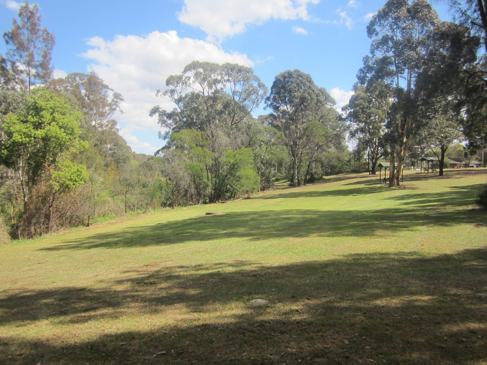
View across Third Settlement Reserve looking west. 
Third Settlement Reserve straddles Toongabbie Creek adjacent to Edison Parade at Winston Hills, and Settlers Walk is in Oakes Reserve on the western side of Oakes Road in Old Toongabbie.

"Toon-gab-be'' as it was then known was the Third Settlement in the Colony (after Sydeny Cove and Parramatta) and the site of the Government Farm established by Governor Phillip in 1791.

Under the direction of Superintendant Thomas Daveney, Phillip's aim was to open up more agricultural land for the Colony after the arrival of the Second Fleet. By 1792 it has become the principal farm of the Colony with approximately 696 acres (281.6 hectacres) being sown with wheat, maize and barley. Some 500 convicts, mainly from the Third Fleet, were assigned to the Farm. Conditions under Daveney were harsh. Toongabbie was the first place of secondary punishment in the Colony. Also most of the Irish convicts transportedbetween 1797 and 1801 were sent there.

The actual site of the convict township which existed between 1791-1803 was on the western bank of Toongabbie Creek between what is today Old Windsor and Oakes Roads in Old Toongabbie - site of Baxter Healthcare and the Endeavour Energy Substation.

The extent of the actual farming land is probably a matter of conjecture, but signage in Third Settlement  Reserve states "Today's Junction and Gibbon Roads were originally the 'Toongabbee Road' which followed the northern boundary of the Government Farm". This would place the areas under cultivation on the northern banks of the Creek in the present day Winston Hills.

The NSW Government Office of Environment and Heritage has prepared a Toongabbie Government Farm Archaeological Site Draft (June 2012) which has very valuable information on the site.

There is very little above ground evidence remaining of the Government Farm site today. But we did locate a set of seven sandstone steps cut into the bedrock of Toongabbie Creek at the northern end of its north-south reach, on the eastern side, just off Goliath Avenue, Winston Hills.

The first four steps are shallow with pecked surfaces that are consistent with the work of convict labourers. The above three steps are likely to be be of later origin, probably the work of George Oakes in the 1860s in connection with the construction of the nearby weir across the Creek to provide a private swimming pool for his residence.

View of Sandstone Steps leading down to Toongabbie Creek,
looking east from Settlers Walk.  


Evidence of convict pick marks in the sandstone steps. 

View across Toongabbie Creek looking south-west to
Oakes Reserve.

History Services NSW in its Convict Database, has detailed records of 115 convicts who were either assigned to, or settled in the Toongabbie area, including: 
  • William JOYCE per Abermarle, arriving in Port Jackson on 13 October 1791 from Portsmouth (Third Fleet). Granted land at Toongabbie in 1794. Married Sarah Jackson per Brittania on 19 August 1799 at St Johns, Parramatta. In 1804 he rode to Parramatta to warn authorities that the convicts had rebelled at Castle Hill;
  • John PYE per Brittania arriving in Port Jackson on 14 October 1791 from Portsmouth (Third Fleet). Married Mary Phillips per Mary Ann on 11 December 1791 at St Johns, Parramatta. Granted land in 1796 and settled at Toongabbie;
  • Kennedy MURRAY per Pitt arriving in Port Jackson on 14 February 1972 from Yarmouth Rds. Initially assigned to the Toongabbie Convict Farm. In 1796 he was sent to Norfolk Island.
  • Bryan (Berny) REILLY per Boddingtons arriving in Port Jackson on 7 August 1793 from Cork. Granted land at Toongabbie in December 1799. In 1804, he took part in the Battle at Castle Hill  and was sentenced to receive as many lashes as he could stand.

If you are interested in researching a convict ancestor from the Toongabbie area,  go to our website at :
http://www.historyservices.com.au/convicts.htm

*********************************************************************************
Blog prepared by Mary McGuinness.                                                      All photos taken September 2012


Sunday, September 9, 2012

Bradley's Head - Forts and Memorials

Memorial Mast of HMAS Sydney1
Bradley's Head at Mosman in Sydney NSW is a prominent headland on the northern side of Sydney Harbour between Taylors Bay and Athol Bay. Its history lies in the story of the fortification of Sydney Habour.

Today it is the proud site of an Australian naval monument, housing the Memorial Mast of HMAS Sydney 1 astride the original 1840 fort. This is the only naval monument in Australia requiring ceremonial honours to be rendered by all passing naval ships.

There are also memorials to the personnel of other Royal Australian Navy vessels including the four HMAS Sydney ships.

View with the memorial to the four HMAS Sydney
Ships in the foreground
It was in 1840 that the construction of forts began on Bradley's Head and Pinchgut (later Fort Dension) using convict labour, under the direction of Major George Barney, the First Colonial Engineer.

A sandstone wharf was also built at Bradley's Head in conjunction with the fort. It was used to transport supplies and equipment from Sydney Cove to the site.

View of the remains of the original 1840 fort
(site of the Memorial Mast ) and the 1854 fort to the left   

Sandstone Wharf circa 1840

Piece of crockery found embedded in the sandstone wharf

Other features at Bradley's Head are:

1)  a Doric column which originally stood at the GPO in George Street Sydney and was relocated to Bradley's Head in 1871 to mark one nautical mile from the centre of the Martello Tower at Fort Denison. It was used to provide accurate sea trial measurements.

Doric Column at Bradley's Head


Harbour view between Bradley's Head and Fort Denison


2) Bradleys Head Lighthouse.  Constructed in 1905 with electric beacon and foghorn, this timber and concrete lighthouse operates today as a navigational marker and warning light to ships entering and leaving the Harbour.


3) 1871 Fortifications. Construction began in 1870 on higher ground above the earlier emplacements as part of the general concerted effort to fortify the outer Harbour locations. The battery complex on Bradley's Head consisted of five circular gun placements interconnecting tunnels, trenches and galleries either cut from bedrock or built up by stone masonary.

1871 Gun placement. Markings on the gun barrel read
"Low Moor 10925  1861"
Main Firing Wall of the Bradley's Head Fortification complex
*********************************************************************************

History Services NSW has records of convict assigned to Major Barney, viz:
  • William CHENERY per Recovery, arriving at Port Jackson on 25 February 1836. Recorded in 1837 as being "with Major Barney, Sydney, aged 30".
  • John REDDISH per Earl Grey arriving at Port Jackson on 21 November 1838. Recorded in 1984 as having "äbsconded from Major Barney's Boats Crew, Sydney since 3 February 1840"', and
  • James O'MARA per Heber arriving at Port Jackson on 12 July 1837. REcorded in 1837 as being ''with Major Barney,  Sydney, aged 26''.

If you are interested in researching convict history got to our website at :
http://www.historyservices.com.au/convicts.htm

All photos taken August 2012

Monday, August 6, 2012

Taylors Bay - Its Place in Sydney's History


Taylors Bay, Sydney Harbour - August 2012 . 
Taylors Bay is located between Chowder Head and Bradley's Head in Sydney Harbour. Today it a very peaceful spot with a beautiful little secluded beach. But in 1942, it was the bay into which the Japanese HA-21 Type A Midget Submarine (also known as M22) sank to the sea bed on the ill-fated night of 31 May/1 June when three enemy submarines came to Sydney.

On that night, HA-21 was manned by Lieutenant Keiu Matsuo and Petty Officer First Class Masao Tsuzuku. It was first detected in the Harbour about 11pm and was depth charged by the patrol boat HMAS Yandra. It surfaced at 3.50am at Neutral Bay where it was fired on by HMS Kaminbla. Between 5am to 8.30 am it was trapped in Taylors Bay and again heavily depth charged by the three patrol boats, HMAS Steady Hour, Sea Mist and Yarroma. At some point the crew committed suicide.

The submarine was salvaged within a week by the Royal Australian Navy and taken to Clark Island. It was badly battered. A series of postcards was produced to record the story of the Japanese midget submarines in Sydney Harbour..

I recalled I have one such postcard, Serial No 6 dated 30 July 1942 which shows the salvage party at work at Taylors Bay using a floating crane. A similar photo is incorporated in the plaque in the photo at top.

Salvage of HA-21 at Taylors Bay - Postcard Serial No 6
dated 30 July 1942
I have previously researched the story of the Japanese midget submarines in my blog, Sydney Harbour War Time Boom Net, dated  31 May 2011.

It was very interesting then to actually visit Taylors Bay and locate a piece of Sydney's history.

                   ***************************************************************************** 
If you are interested in researching Australian history, go to our website at:
http://www.historyservices.com.au/

Wednesday, August 1, 2012

Bedlam Point Convict Precinct

  
Remains of the Bedlam Point Wharf looking across to Abbotsford - July 2012
On the eastern side of Looking Glass Bay is Bedlam Point. Many times we have looked across the Parramatta River to this point from Abbotsford Wharf but we had not explored the area until recently.

What is the story of Bedlam Point?

The area was named Bethlem Point as early as 1820 and was officially called Bedlam Point soon afterwards. Bedlam is a corruption of Bethlam/Bethlehem which was the name of England's first lunatic asylum. Although the origins of our local naming are unclear, it certainly predates the building of the nearby Tarban Creek Lunatic Asylum in 1838. [Angela Phippen and Margaret Farlow, Dictionary of Sydney 2008].

The distance between Bedlam Point and Abbotsford, at some 200 metres, is the narrowest point of the Parramatta River below Homebush Bay. In 1828, the Surveyor-General, Sir Thomas Mitchell recommended a crossing of the river here to facilitate a 'New Line' of the Great North Road through Abbotsford on the southern side to points on the northern shore.

From Bedlam Point, the Great North Road climbed up the hill to a government flagstaff (located near the site of today's Gladesville Post Office) and continued north-west along the ridge of today's Victoria Road to St Anne's Church at Ryde and then through Epping and Pennant Hills to join the old Great North Road at Dural. Construction of this section took place in 1829-31.

A cable-driven punt was established in 1832 from Abbotsford to Bedlam Point to ferry people, produce, livestock and carriages across the river. It was the only river crossing for some thirty years before being decommissioned in 1860's. 


Overgrown scrub on the original roadway to the Bedlam Point Wharf - July 2012
On site exploration at Bedlam Point is quite challenging. A lot of the area has been now overtaken by lantana bushes and over the years it appears that much hard fill has been dumped   on what would have been the original rubble paved roadway down to the shore.

However we were able to find some exciting evidence of convict history.

Convicts were employed in the area to work both on the building of a ferry wharf and the Great North Road extension. 
Our discoveries were:

1)The remains of the stone ferry wharf built by convicts in 1834 as seen in the photo at top.


2) A plaque telling the story of the Bedlam Point Convict Precinct. It was lain in a rock which bore a wedge-pit mark of a convict steel spike which would have been driven into the rock to break off a section. This pointer gave us a good idea of the likely line of the edge of the road leading down to the shore.


Plaque and Convict Rock
3) An interesting date carved into a rock - seemingly XVII XI?

Rock outdrop with convict carvings
4) A Latin phrase, De Mortious Nil Nisi Bonum which loosely translates as "Speak no ill of the Dead", carved along the top of the rock above. As the work of a convict labourer it may give us a clue to the thoughts of those working in the road gangs, or at the very least point to a skilled and well educated stoenmason. The initials ''AK'' appear above the inscription.


De Mortious Nil Nisi Bonum
 4) More initials carved into the rock. It is not possible to precisely identify to whom they may have belonged, but they are an interesting piece of colonial 'graffiti.'

''LG''


"M J"


5) Convict pick marks in rocks on the right hand side of Punt Road looking up the hill. These rocks formed the roadside gutters for drainage.  

Convict Pick marks on the edge of the road
View looking up Punt Road with the above rocks at the mid right of photo  - July 2012
History Services NSW has records of two convicts that were known to have worked in the Bedlam Point area, viz:

George Frederick BROWN - per Royal Admiral, being recorded in 1832 as having been ''apprehended after abscondment from Bedlam Point'', and

William JONES - per Georgiana, being recorded in 1834 as having been  ''apprehended after abscondment from Detached Party, Bedlam Point''.

If you are researching a convict ancestor who may have worked on the Great North Road and  require more information, you should go to our website at : 
http://www.historyservices.com.au/convicts.htm


Saturday, July 14, 2012

Looking Glass Bay

Looking Glass Bay - July 2012
At the end of Punt Road at Gladesville (Sydney, New South Wales), looking up the Parramatta River is a bay with beautifully clear water which reflects its surroundings. It is known as Looking Glass Bay.

How did it get its name?

On its western shore (near the Shore School Rowing Shed), there is a plaque which reads:
Plaque commemorating CaptainArthur Phillip''s Landing
Just after the arrival of the First Fleet at Sydney Cove, Captain Arthur Phillip, Lieutenant William Bradley and James Keltie (Master of the Sirius) were taking a party up the River to explore the area that Bradley had previously named "The Flats" (present day Homebush Bay). Lieutenant Bradley explains in an extract from his journal about their stop at Looking Glass Bay:

We stopped at a Neck of Land for breakfast. We were soon met there by a Native arm'd. He laid down his spear as soon as he joined us, & had more curiosity than any we had met with. He examined everything attentively & amp;and went into all our boats from one to the other...The Governor gave this Man a hatchet, & a looking-glass, which, when he looked into, he looked immediately behind the Glass to see if any person was there, & then pointed to the Glass and the Shadows which he saw in the Water, signifying that they were similar.
[Lieutenant William Bradley, 15 February 1788']


In its later life, Looking Glass Bay was home to :
1) Rock End Cottage, built in the late 1830's as an inn and from 1866 to 1909 home to  the grandmother of the Australin poet, A B (Banjo) Paterson: and

Rock End Cottage at Looking Glass Bay - July 2012
2) Harold Meggitt Limited a leading producer in the edible vegetable oil industry from 1923 to its closure in 1973. 

The Harold Meggitt Story


**********************************************************************************************************************


If you are interested in researching Australian history, go to our website at:
http://www.historyservices.com.au/


Sunday, July 8, 2012

Third Quarantine Cemetery

Entrance to the Third Quarantine Cemetery, North Head Sanctuary - July 2012
On a return visit to North Head Sanctuary (fascinating place!), we found the Third Quarantine Cemetery atop the ridge with great views over Sydney Harbour. This Cemetery was established in 1881 for the victims of a smallpox outbreak. It closed in 1925 and contains the graves of some 241 people.

Many of these were victims of the bubonic plague which came to Sydney in 1900. They were mainly young people and and children which made for sobering reading.


Grave of Maggie Whitehead - Third Quarantine Cemetery, July 2012


One interesting grave was that of Maggie Whitehead of Borambil Station near Condobolin, New South Wales.

What was her story?

According to Obituaries Australia 2010-2012, Maggie Whitehead, aged 40 years, was visiting Sydney en route to England. She contracted the bubonic plague and was taken to the Quarantine Station where she lasted only three days, dying on 3 May 1900. She was the wife of Richard Whitehead of Borambil and the eldest daughter of Alexander and Jessie Cameron of Satimur Station in Western Victoria.

                   ***************************************************************************** 
If you are interested in researching Australian history, go to our website at:
http://www.historyservices.com.au/