Monday, April 1, 2013

Sydney Tram Memories

With the proposed return of trams to the streets of Sydney (Sydney's Light Rail Future - December 2012), it is interesting to see reminders of our previous tramway history at various locations throughout Sydney. These include:

1. Several ornate tram shelters which are still standing, including the one at Balmoral Beach and another on Elizabeth Street, Sydney opposite the Great Synagogue.  

Tram shelter at Balmoral Beach - May 2012
  
Tram Shelter, Elizabeth St, Sydney - March 2013

2.  Ornamental rosettes located on many older buildings and rock faces where overhead wiring span wires for the trams were attached. 

Two rosettes on a building in George Street, Sydney - September 2012

Rosette on the David Jones Building a the corner of Castlereagh and
 Market Sts, Sydney - September 2012. 
Note the rounded front on the David Jones (Market Street) building. Many street corners were 'cut-back' to allow space for trams to turn. Many of the building on such corners still have rounded fronts.


Rosette on the rock face in Lawry Plunkett Reservce at Balmoral, on the route
of the  Balmoral tramline - May 2012
There are seven rosettes on the rock face near the Sydney Opera House at the site of what was the Fort Macquarie Depot.

Two of the rosettes on the rock face near the Sydney Opera House -
March 2013
View of the rock face near Sydney Opera House
 at the site of the Fort Macquarie Tram Depot - March 2013
3) Tram  tracks on Glebe Point Road at Glebe. A small section of the original tram tracks were uncovered by roadworks in 2009. The City of Sydney Council left them exposed as a historical reminder.


Tram tracks in Glebe Point Road at Glebe - 8 May 2012
4) The tunnel portals for the tram tracks running across the Sydney Harbour Bridge to the underground tram terminus at Wynyard Railway Station. These can been seen from the pedestrian walkway on the eastern side of the Bridge.        

Tunnel Portals to Wynyard from the Sydney Harbour Bridge - May 2011

5) Site of McMahons Point Electric Tram Terminus 1909 - 1932. The double track along Blues Point Road formed a loop here by the Ferry Wharf providing an extra link with the city from the North Shore Suburbs. The line was not needed after the opening of the Sydney Harbour Bridge in 1932.

Site of McMahons Point Tram Terminus - May 2012


Tram monument at McMahons Point Wharf (mid right of photo) - May 2012, 

6) Two monuments commemorating the extension of the tramway from Drummoyne to Ryde in 1910. The first which is now located at the rear of the Ryde Civic Centre was unveiled in December 1908 to mark the 'turning of the first sod' for the extension of the tramway from Drummoyne to Ryde. The actual terminus for the line was located near the intersection of Pope and Devlin Streets adjacent to the current Top Ryde Shopping Centre. 

Ryde Tramway Monument located at the rear of the Ryde Civic Centre in
 Devlin Street - August 2012

Inscription on Ryde Tramway Monument - August 2012
The second is the Sutton Memorial Tramway Monument in Ryde Road at Monash Park. This was unveiled to commemorate the opening of the new tramway on 11 June 1910, and in memory of Joseph Sutton, son of Ryde Alderman Rowland Sutton. It was originally erected at the intersection of Wharf and Victoria Roads at Gladesville.


Sutton Memorial Tramway Monument, Ryde Road ,
Monash Park - August 2012

7) Rozelle Tram Depot at Glebe which was the second largest tram depot on the Sydney network from 1904 until its closure in 1958. Today is it part of the Harold Park development by the Mirvac group. The heritage listed sheds which are on the northern edge of Harold Park will form the retail heart of the complex. 


Site of the Rozelle Tram Depot.
Heritage listed sheds in the background - May 2012
                    ********************************************************************************


Tram Memorial Plaque in Devonshire Street Tunnel, Central Railway
- May 2011
Trams first ran in Sydney in 1867. 

History Services NSW in its Government Contracts and Contractors Database has over three hundred records relating to granting of NSW Government contracts for the Sydney tram network from that period to 1900 when most of the metropolitan network was built.

If you are interested in further information go to our website at :
http://www.historyservices.com.au/

All photos taken 2011-2013.

Blog prepared by Mary McGuinness


Thursday, March 7, 2013

Crossing the Blue Mountains - The Starting Point

With the bi-centenary of the first crossing of the Blue Mountains by Europeans in 1813 coming up in May 2013, there will be many celebrations and re-enactments. Interesting details of theexpedition will emerge.

Warren Brown, editorial newspaper cartoonist for Sydney's Daily Telegraph, is currently retracing the route of the explorers Gregory Blaxland, William Charles Wentworth and William Lawson. He wanted to begin at their exact starting point on Gregory Blaxland's farm near South Creek [Daily Telegraph, 5 March 2013].

We had previously located a memorial cairn to the three explorers in Luddenham Road at Orchard Hills adjacent to the former site of Blaxland's farm "Leeholme". It was erected in 1938 and marks the staring point of the Blaxland, Lawson and Wentworth expedition on 11 May 1813. 

Explorers Memorial Cairn on Luddenham Road , Orchard Hill
 Photo taken September 2011

"Here on the South Creek
 was Gregory Blaxland's farm
From it on May 11, 1813
he set out with
William Lawson and WC Wentworth
attended by four servants
with four pack horses and five dogs
on the first expedition
that crossed the Blue Mountains .

-----------------------
Citizens of St Marys 1938

Official records of the expedition, including the diaries of the explorers make no mention of the names of the 'four servants' that accompanied them.

History Services NSW has records, sourced from State Records, for five convicts who were remunerated for their services in crossing the Blue Mountains. These convicts were:

James Byrne per Anne, arriving in Port Jackson on 21 February 1801 from Cork, Ireland, who was:
  • paid from Police Fund for services as a guide to the party who crossed the Blue Mountains, document dated 5 February 1814 [State Records reel 6038 page 456, SZ758];
  • paid from Police Fund for services in making discoveries west of the Blue Mountains, document dated 30 April 1814 [State Records reel 6038 page 489, SZ758].
  • on the list of persons who are to receive grants of land in December 1814 for crossing the Blue Mountains, document dated 12 Dec 1814 [State Records Fiche 3266 page 20, 9/2652].
John Cogan  per Tellicherry, arriving in Port Jackson on 15 February 1806 from Cork;  
Richard Lewis
per Coromandel 
arriving in Port Jackson on 13 June 1802 from Spithead; 
John Tighe (Tygue) per Anne, arriving in Port Jackson on 21 February 1801 from Cork; and, 
John Grover per Anne arriving in Port Jackson on 27 February 1810 from England;
who were all:
  • paid from Police Fund for services in making discoveries west of the Blue Mountains, document dated 30 April 1814 [State Records reel 6038 page 489, SZ758].
  • on the list of persons who are to receive grants of land in December 1814 for crossing the Blue Mountains, document dated 12 Dec 1814 [State Records Fiche 3266 page 20, 9/2652].
The earlier date of 5 February 1814 for James Byrne,as well as corroborated research, would indicate that he was part of the first expedition over the Blue Mountains.

It has been established that the other four convicts accompanied George Evans on the second journey over the Blue Mountains in November 1813 [Footsteps in Time: A Road Across the Mountains, John Yeaman 2010].

            **********************************************************************************

History Services NSW has  records of  sixty-nine convicts who took part in further expeditions of discovery with the early explorers.

If you are researching a convict ancestor, you should go to our website at: http://www.historyservices.com.au/convicts.htm


Blog prepared by Mary McGuinness

All photos taken in September 2011

Tuesday, November 20, 2012

Convict Lumber Yard at Newcastle

 Convict Lumber Yard at Newcastle showing re-created site of the main building. 
There is a very significant piece of convict history in the heart of Newcastle, NSW. It is the Convict Lumber Yard, located just off Foreshore Park between Scott and Bond Streets at Newcastle.

The scene of an extensive archaeological dig between 1989 and 1992, the site today houses the remains of one of the oldest surviving convict work places in Australia. It also marks the birthplace of industry in Newcastle.


Sculpture depicting the Convict Lumber Yard
View looking up Bond Street


From 1804 to 1822, Newcastle was a penal settlement established for the punishment of secondary offenders. Convicts were employed in the coal, timber and lime-burning industries. An area near the government wharf at the bottom of George Street (now Watt Street) was used for storage of these materials. It became known as the Lumber Yard. A convict barracks and workshop were built on the site. 

When Newcastle became a free settlement in 1822 some convicts were retained there to work in the coal mines. The building was used as a carpenter' and wheelwright's 'shop. In 1831 when the government withdrew from coal mining, the Lumber Yard was used to house convicts employed in the building of Nobbys Breakwater which was completed in 1846. After a period in private use the building was destroyed by fire in 1851. Sand drifts covered the site so preserving the convict relics.

A walk through the site today is very interesting as the story of the Lumber Yard is re-created from the discoveries of the archaeological excavations. These showed evidence of heavy industry including tools, forges and saw pits. Sections of the lower walls of the barracks and floor paving were also uncovered. There was still some evidence of the fire. 

Approaching the site from Watt Street

The top of a well whose paving and stonework materials may have been re-used from ruined buildings of the convict era, is a prominent feature. 

Site of a well used to obtain water for  nearby cottages and 
railway premises in the 19th and 20th centuries. Brick paving and 
stonework around the well may have been re-used from
 buildings of the earlier convict period.

The remains of the footings of the Guardhouse and the Sergeant's Quarters have also been re-created and sited in steel structures.
Location of the Guard House site

Another view of the Guardhouse site
Location of the footings of the Sergeant's Quarters which 
extend into  the present Customs House site. The footings were 
uncovered  by excavation in 1992.


****************************************************************************

History Services NSW has extensive records of convicts who were assigned to the Newcastle area.

If you are researching a convict ancestor who was assigned to the Newcastle area, you should go to our website at: http://www.historyservices.com.au/convicts.htm

I also refer you to my previous blog of 28 March 2010, Governor Macquarie Visits Newcastle


Blog prepared by Mary McGuinness

All photos taken in October 2012


Wednesday, November 14, 2012

Depression Era Heritage in Thornleigh?

Sandstone hut - Thornleigh
There was a very interesting article in the October 2012 issue of the The Monthly Chronicle entitled Mysterious Stone Structures - Can you help?

It reports on the discovery by Stephen Pym, a bushland field officer, of "some interesting sandstone structures" on land leased by Scouts Australia NSW near the Baden-Powell Scout Centre in Orchard Street, Thornleigh, NSW.

We visited the site, located on a track on the southern edge of the scout land near where it adjoins the Lane Cove National Park. The track is marked by a wooden walkway just off the main perimeter track.

Indeed the site is a real historical treasure. While not being able to furnish any precise details of habitation or ownership, we can postulate that the area was at some time someone's permanent home.

Closer inspection of the "rock shelter" reveals a piped air vent and the remains of a door fitting suggesting a permanent hut for accommodation. Adjacent to the hut is an area where there is evidence of fires having been lit.


View of hut showing air vent (pipe in top left corner) and
 the evidence of a door fitting on the right hand wall entrance

Closer view of the door fitting 

Area adjacent to the hut showing evidence of fires

Also the inhabitant had obviously had made a significant attempt to landscape the area as seen in the several layers of gardens supported by retaining walls, carved out steps and innovative garden structures.

Sandstone steps 

Garden bed formed in a rock base with a shaped cement top

A wide shot of the garden bed and steps

Layered sections of garden with retaining walls
A landscape garden


On the website of the Baden-Powell Scout Centre , it states that "during the Depression, the Centre became the permanent camping site for many who were out of work, and they built the camping flats, chapel and many of the stone paths and gardens".

In previous blogs, History Services NSW has explored Depression Era Housing on Sydney Harbour (23 November 2010) and in Conscript Pass and Lorna Brand  (25 April 2011) has told the story of how the nearby Lorna Pass was built as a relief effort during the Depression.

It would be excellent if the story of the "house and garden site" in Thornleigh could be acknowledged by way of signage or a memorial to preserve its heritage.


          *******************************************************

If you are interested in researching Australian history go to our website at :
http://www.historyservices.com.au/

All photos taken November 2012

Blog prepared by Mary McGuinness

Monday, October 29, 2012

An Aboriginal Inheritance at Shoal Bay

The earliest inhabitants of the Port Stephens area were the Aboriginal people of the Worimi tribe.

The Worimi tribe consisted of the Grewerogal, Gampingal and Maiangal groups who lived on the waterfronts around the Port Stephens. 

There are many examples of Aboriginal occupation sites in Port Stephens which are still evident today such as shell middens and scarred trees. The sites are protected by law.

Signage for the Tomaree Coastal Walk from Tomaree Head to Fingal Bay
View from Tomaree Head overlooking Xenith, Wreck and Box Beaches
and out to the Final Bay Spit
On the Tomaree Coastal Walk, mid-way along the track to Wreck Beach adjacent to the entrance from Jolleen Crescent, Shoal Bay, there is a significant local Aboriginal shell midden.

A midden is a mound made up of the remains of  shells, fish bones, charcoal, the bones of mammals and sometimes tools. They are generally found at important sites where Aboriginal people have gathered. In coastal areas, they are found near places of good fishing or abundant shellfish, near rocky headlands and estuaries.[ Port Stephens - Great lakes Marine Park, Teacher Fact Sheet, Module 4 Sea and Country].

This midden is located on the steep incline up from the shoreline of Shoal Bay and has obviously been uncovered by the excavation of the fire trail which is the present day track. It extends over a large area.
It is also quite deep as indicated by the various layers which are evident in the photos below. It would have been laid down over a considerable period of time and would hold much Aboriginal history.

Aboriginal midden on the Wreck Beach track showing various layers

 A front-on view of the layered midden on the Wreck Beach track
A closer view of the shells in the midden
Also nearby the Jolleen Crescent entrance to the walking track, there is an Aboriginal scarred tree. These trees were carved out by Aborigines for various purposes such as building canoes or shields. This one would probably be for a spear. There are several examples of scarred trees around Port Stephens including the "canoe" trees at Little Beach

Aboriginal scarred tree  - near  Joleen Crescent, Shoal Bay
As an interesting sideline, there is a photo, from the Australian Museum, of a re-creation of the Aboriginal technique of tree carving. This can been found on the Information board in parkland at Carlingford, NSW, along Hornsby Council's Pioneer Track just near the Roselea Public School.


********************************************************************************

The Nelson Bay, Port Stephens and Newcastle area is rich in early Australian history.
If you are interested in researching Australian history go to our website at :
http://www.historyservices.com.au/convicts.htm

All photos taken October 2012

Blog prepared by Mary McGuinness


Jollenn

Tuesday, October 23, 2012

Climbing Tomaree Head


View of Port Stephens from Tomaree Head  - October 2012
Tomaree Head is the headland on the southern side of the entrance to Port Stephens, New South Wales. Port Stephens was first sighted and named by Captain Cook in May 1770. It is a large natural harbour just to the north of Newcastle.

The summit of Tomaree Head is 161 metres (528 Feet) above sea level. Some 100,000 visitors make the climb to the summit each year. The track up is quite steep on the lower slopes as it winds through shady blackbutt forest. As you approach the summit the vegetation changes to a drier woodland and you have then a panoramic 360 degree view over Port Stephens and the eastern coastline. Magnificent. Well worth the climb!

In World War II, because of its proximity to the port and steelworks at Newcastle, the Port Stephens area was chosen as defence hub in Australia's war effort against a possible Japanese invasion.

In 1942, the Royal Australian Air Force (RAAF) erected a Radar Station on the summit of Tomaree Head, for the purpose of detecting enemy shipping and monitoring flight movements within a 120 km range. It was the longest serving RAAF radar in World War II operating until 1947.

Site of the Radar Station today exhibiting the Radar Aerial turning gear
which stood underneath the radar tower.

Remains of a structure in the Radar Station complex.

Remains of a rock structure on the summit. During the war years
buildings at the Radar Station  were camouflaged, by mesh and
cement to make them appear like rocks

A heavy battery artillery fort was also constructed on the lower slopes of Tomaree Headland in 1942. Fort Tomaree, as it was called consisted of two 6 inch (152m) guns; two 3 pounder guns; torpedo tubes; mortars; machine guns; rifle pits; search lights; command posts; observation posts; barbed wire entanglements and accommodation.

The 'Guns of Tomaree' were never fired in anger but Fort Tomaree was an important military base in the days of  World War II. Walking tracks on the lower slopes of the headland and around the shoreline reveal the remains of this heritage today.

No 1 Gun Placement on Tomaree Headland


Concrete utility room on Tomaree Headland
Remains of old rail tracks on Tomaree Headland


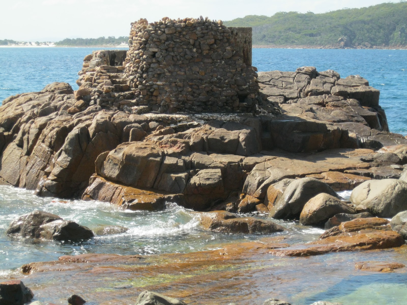
Remains of a torpedo tube off Tomaree Headland

No 2 surf gun (3 Pounder) off Tomaree Headland

 *****************************************************************************
The Nelson Bay, Port Stephens and Newcastle area is rich in early Australian history.
 
If you are interested in researching Australian history go to our website at :
http://www.historyservices.com.au/convicts.htm

All photos taken October 2012

Blog prepared by Mary McGuinness