Tuesday, November 20, 2012

Convict Lumber Yard at Newcastle

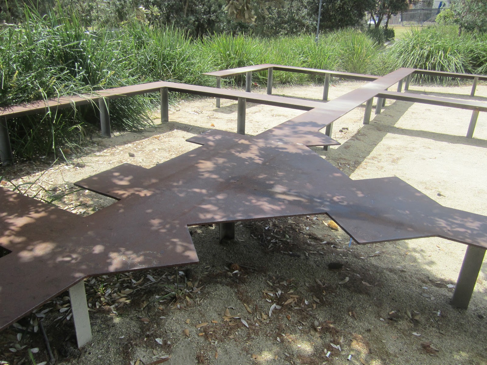
 Convict Lumber Yard at Newcastle showing re-created site of the main building. 
There is a very significant piece of convict history in the heart of Newcastle, NSW. It is the Convict Lumber Yard, located just off Foreshore Park between Scott and Bond Streets at Newcastle.

The scene of an extensive archaeological dig between 1989 and 1992, the site today houses the remains of one of the oldest surviving convict work places in Australia. It also marks the birthplace of industry in Newcastle.


Sculpture depicting the Convict Lumber Yard
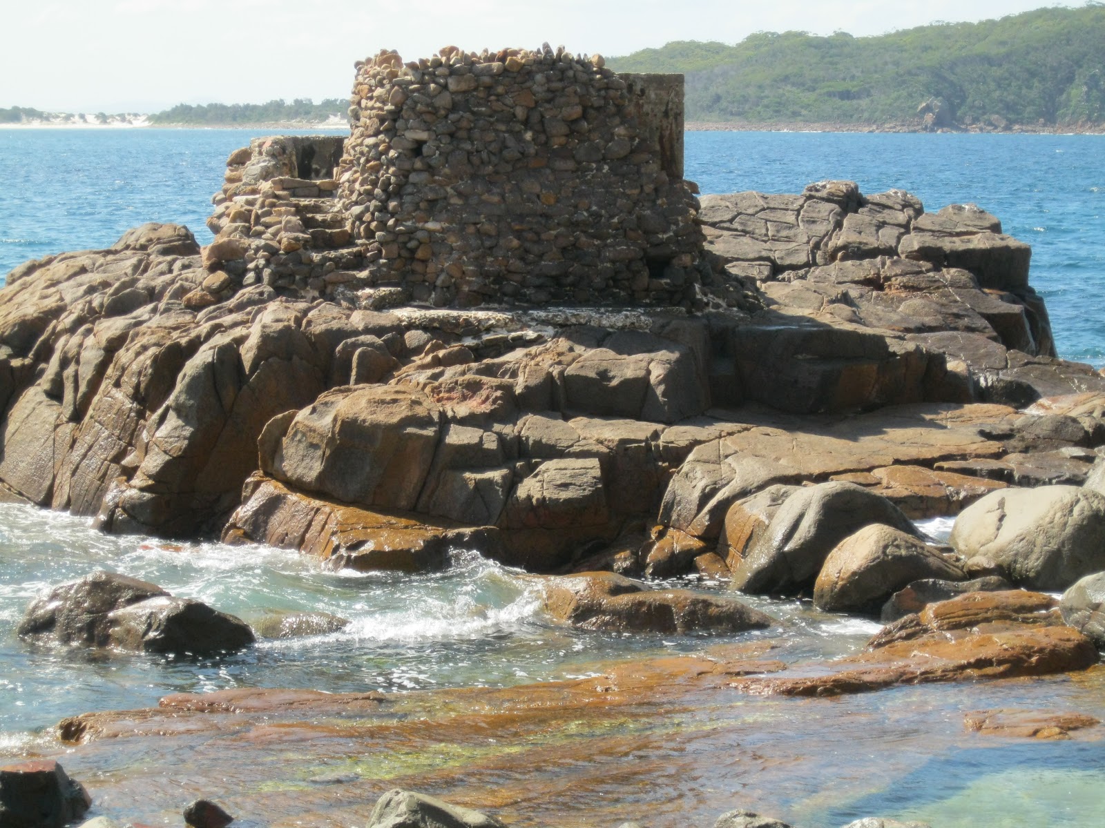
View looking up Bond Street


From 1804 to 1822, Newcastle was a penal settlement established for the punishment of secondary offenders. Convicts were employed in the coal, timber and lime-burning industries. An area near the government wharf at the bottom of George Street (now Watt Street) was used for storage of these materials. It became known as the Lumber Yard. A convict barracks and workshop were built on the site. 

When Newcastle became a free settlement in 1822 some convicts were retained there to work in the coal mines. The building was used as a carpenter' and wheelwright's 'shop. In 1831 when the government withdrew from coal mining, the Lumber Yard was used to house convicts employed in the building of Nobbys Breakwater which was completed in 1846. After a period in private use the building was destroyed by fire in 1851. Sand drifts covered the site so preserving the convict relics.

A walk through the site today is very interesting as the story of the Lumber Yard is re-created from the discoveries of the archaeological excavations. These showed evidence of heavy industry including tools, forges and saw pits. Sections of the lower walls of the barracks and floor paving were also uncovered. There was still some evidence of the fire. 

Approaching the site from Watt Street

The top of a well whose paving and stonework materials may have been re-used from ruined buildings of the convict era, is a prominent feature. 

Site of a well used to obtain water for  nearby cottages and 
railway premises in the 19th and 20th centuries. Brick paving and 
stonework around the well may have been re-used from
 buildings of the earlier convict period.

The remains of the footings of the Guardhouse and the Sergeant's Quarters have also been re-created and sited in steel structures.
Location of the Guard House site

Another view of the Guardhouse site
Location of the footings of the Sergeant's Quarters which 
extend into  the present Customs House site. The footings were 
uncovered  by excavation in 1992.


****************************************************************************

History Services NSW has extensive records of convicts who were assigned to the Newcastle area.

If you are researching a convict ancestor who was assigned to the Newcastle area, you should go to our website at: http://www.historyservices.com.au/convicts.htm

I also refer you to my previous blog of 28 March 2010, Governor Macquarie Visits Newcastle


Blog prepared by Mary McGuinness

All photos taken in October 2012


Wednesday, November 14, 2012

Depression Era Heritage in Thornleigh?

Sandstone hut - Thornleigh
There was a very interesting article in the October 2012 issue of the The Monthly Chronicle entitled Mysterious Stone Structures - Can you help?

It reports on the discovery by Stephen Pym, a bushland field officer, of "some interesting sandstone structures" on land leased by Scouts Australia NSW near the Baden-Powell Scout Centre in Orchard Street, Thornleigh, NSW.

We visited the site, located on a track on the southern edge of the scout land near where it adjoins the Lane Cove National Park. The track is marked by a wooden walkway just off the main perimeter track.

Indeed the site is a real historical treasure. While not being able to furnish any precise details of habitation or ownership, we can postulate that the area was at some time someone's permanent home.

Closer inspection of the "rock shelter" reveals a piped air vent and the remains of a door fitting suggesting a permanent hut for accommodation. Adjacent to the hut is an area where there is evidence of fires having been lit.


View of hut showing air vent (pipe in top left corner) and
 the evidence of a door fitting on the right hand wall entrance

Closer view of the door fitting 

Area adjacent to the hut showing evidence of fires

Also the inhabitant had obviously had made a significant attempt to landscape the area as seen in the several layers of gardens supported by retaining walls, carved out steps and innovative garden structures.

Sandstone steps 

Garden bed formed in a rock base with a shaped cement top

A wide shot of the garden bed and steps

Layered sections of garden with retaining walls
A landscape garden


On the website of the Baden-Powell Scout Centre , it states that "during the Depression, the Centre became the permanent camping site for many who were out of work, and they built the camping flats, chapel and many of the stone paths and gardens".

In previous blogs, History Services NSW has explored Depression Era Housing on Sydney Harbour (23 November 2010) and in Conscript Pass and Lorna Brand  (25 April 2011) has told the story of how the nearby Lorna Pass was built as a relief effort during the Depression.

It would be excellent if the story of the "house and garden site" in Thornleigh could be acknowledged by way of signage or a memorial to preserve its heritage.


          *******************************************************

If you are interested in researching Australian history go to our website at :
http://www.historyservices.com.au/

All photos taken November 2012

Blog prepared by Mary McGuinness

Monday, October 29, 2012

An Aboriginal Inheritance at Shoal Bay

The earliest inhabitants of the Port Stephens area were the Aboriginal people of the Worimi tribe.

The Worimi tribe consisted of the Grewerogal, Gampingal and Maiangal groups who lived on the waterfronts around the Port Stephens. 

There are many examples of Aboriginal occupation sites in Port Stephens which are still evident today such as shell middens and scarred trees. The sites are protected by law.

Signage for the Tomaree Coastal Walk from Tomaree Head to Fingal Bay
View from Tomaree Head overlooking Xenith, Wreck and Box Beaches
and out to the Final Bay Spit
On the Tomaree Coastal Walk, mid-way along the track to Wreck Beach adjacent to the entrance from Jolleen Crescent, Shoal Bay, there is a significant local Aboriginal shell midden.

A midden is a mound made up of the remains of  shells, fish bones, charcoal, the bones of mammals and sometimes tools. They are generally found at important sites where Aboriginal people have gathered. In coastal areas, they are found near places of good fishing or abundant shellfish, near rocky headlands and estuaries.[ Port Stephens - Great lakes Marine Park, Teacher Fact Sheet, Module 4 Sea and Country].

This midden is located on the steep incline up from the shoreline of Shoal Bay and has obviously been uncovered by the excavation of the fire trail which is the present day track. It extends over a large area.
It is also quite deep as indicated by the various layers which are evident in the photos below. It would have been laid down over a considerable period of time and would hold much Aboriginal history.

Aboriginal midden on the Wreck Beach track showing various layers

 A front-on view of the layered midden on the Wreck Beach track
A closer view of the shells in the midden
Also nearby the Jolleen Crescent entrance to the walking track, there is an Aboriginal scarred tree. These trees were carved out by Aborigines for various purposes such as building canoes or shields. This one would probably be for a spear. There are several examples of scarred trees around Port Stephens including the "canoe" trees at Little Beach

Aboriginal scarred tree  - near  Joleen Crescent, Shoal Bay
As an interesting sideline, there is a photo, from the Australian Museum, of a re-creation of the Aboriginal technique of tree carving. This can been found on the Information board in parkland at Carlingford, NSW, along Hornsby Council's Pioneer Track just near the Roselea Public School.


********************************************************************************

The Nelson Bay, Port Stephens and Newcastle area is rich in early Australian history.
If you are interested in researching Australian history go to our website at :
http://www.historyservices.com.au/convicts.htm

All photos taken October 2012

Blog prepared by Mary McGuinness


Jollenn

Tuesday, October 23, 2012

Climbing Tomaree Head


View of Port Stephens from Tomaree Head  - October 2012
Tomaree Head is the headland on the southern side of the entrance to Port Stephens, New South Wales. Port Stephens was first sighted and named by Captain Cook in May 1770. It is a large natural harbour just to the north of Newcastle.

The summit of Tomaree Head is 161 metres (528 Feet) above sea level. Some 100,000 visitors make the climb to the summit each year. The track up is quite steep on the lower slopes as it winds through shady blackbutt forest. As you approach the summit the vegetation changes to a drier woodland and you have then a panoramic 360 degree view over Port Stephens and the eastern coastline. Magnificent. Well worth the climb!

In World War II, because of its proximity to the port and steelworks at Newcastle, the Port Stephens area was chosen as defence hub in Australia's war effort against a possible Japanese invasion.

In 1942, the Royal Australian Air Force (RAAF) erected a Radar Station on the summit of Tomaree Head, for the purpose of detecting enemy shipping and monitoring flight movements within a 120 km range. It was the longest serving RAAF radar in World War II operating until 1947.

Site of the Radar Station today exhibiting the Radar Aerial turning gear
which stood underneath the radar tower.

Remains of a structure in the Radar Station complex.

Remains of a rock structure on the summit. During the war years
buildings at the Radar Station  were camouflaged, by mesh and
cement to make them appear like rocks

A heavy battery artillery fort was also constructed on the lower slopes of Tomaree Headland in 1942. Fort Tomaree, as it was called consisted of two 6 inch (152m) guns; two 3 pounder guns; torpedo tubes; mortars; machine guns; rifle pits; search lights; command posts; observation posts; barbed wire entanglements and accommodation.

The 'Guns of Tomaree' were never fired in anger but Fort Tomaree was an important military base in the days of  World War II. Walking tracks on the lower slopes of the headland and around the shoreline reveal the remains of this heritage today.

No 1 Gun Placement on Tomaree Headland


Concrete utility room on Tomaree Headland
Remains of old rail tracks on Tomaree Headland


Remains of a torpedo tube off Tomaree Headland

No 2 surf gun (3 Pounder) off Tomaree Headland

 *****************************************************************************
The Nelson Bay, Port Stephens and Newcastle area is rich in early Australian history.
 
If you are interested in researching Australian history go to our website at :
http://www.historyservices.com.au/convicts.htm

All photos taken October 2012

Blog prepared by Mary McGuinness

Sunday, October 14, 2012

History at Grotto Point

On the well known Manly to The Spit Walk, there a two side excursions in the Grotto Point Reserve that are rich in history. 

The first is the Grotto Point Aboriginal Engravings. Entering this section of the Reserve from the car park at the end of Cutler Road, Balgowlah Heights, you take the trail to the right, signposted to Castle Rock Beach. After descending a series of stone steps about 100 metres from the car park there several wooden railway sleepers marking the site of the engravings. 

Depicting a kangaroo, fish and boomerangs, the engravings have been dated to the Aboriginal peoples of the Eora group, prior to European settlement. They are very significant in that they are some of the few remaining examples of this type of Aboriginal culture around Sydney Harbour.

Site of the Grotto Point Aboriginal Carvings marked by
railway sleepers

Engraving of a Kangaroo
Engravings of Boomerangs


One example on the site of an engraving of a fish.

Part of a larger engraving depicting a kangaroo, a sun fish
and several smaller fishes
The second excursion is to the Grotto Point Lighthouse overlooking Middle Head. Continuing on from the engravings, you take the track to the left at the major sign post. It is an interesting bush walk down to the lighthouse.

A First Fleet survey party camped at Grotto Point on 28 January 1788.

Construction of the Grotto Point Light  began in 1910 and was first lit on on 1 September 1911. It operates as the front range light at the entrance to Port Jackson and is paired with the Parriwi (Rosherville) Light located just off Parriwi Road up from The Spit, which is the rear range light. Both of these lighthouses were designed  designed by Maurice Festus in a "Disney Castle" architectural style.


Side view of Grotto Point Lighthouse overlooking Balmoral in
the background.
Back view of the lighthouse overlooking Middle Head
and out to sea.

Three interestingly placed stones on the track
leading to the Lighthouse

At nearby Clontarf Reserve, a large Norfolk Pine tree marks the spot where an attempt was made to assassinate HRH The Duke of Edinburgh on 12 March 1868. He was the son of Queen Victoria and was the first member of the Royal family to visit Australia. He was attending a giant picnic for the Sydney Sailors Home at the popular Clontarf Beach. The Duke who was shot in the back, duly recovered. His would-be assassin, Henry James Farrell, a member of an Irish Republican group was charged and hanged. It was not one of our finest historical  moments.
Norfolk Pine Tree at Clontarf Reserve


Plaque commemorating the attempted assassination of HRH,
Duke of Edinburgh


*********************************************************************************

If you are interested in researching Australian history go to our website at :
http://www.historyservices.com.au/convicts.htm

All photos taken October 2012

Blog prepared by Mary McGuinness

Friday, September 28, 2012

Convict History in Old Toongabbie and Winston Hills

We lived in Winston Hills, New South Wales in the 1970s and early 1980s. On a recent visit to the area we were very pleased to see signage at Third Settlement Reserve and Settlers Walk, highlighting the rich convict heritage of the area.
 . 
Third Settlement Reserve 


View across Third Settlement Reserve looking west. 
Third Settlement Reserve straddles Toongabbie Creek adjacent to Edison Parade at Winston Hills, and Settlers Walk is in Oakes Reserve on the western side of Oakes Road in Old Toongabbie.

"Toon-gab-be'' as it was then known was the Third Settlement in the Colony (after Sydeny Cove and Parramatta) and the site of the Government Farm established by Governor Phillip in 1791.

Under the direction of Superintendant Thomas Daveney, Phillip's aim was to open up more agricultural land for the Colony after the arrival of the Second Fleet. By 1792 it has become the principal farm of the Colony with approximately 696 acres (281.6 hectacres) being sown with wheat, maize and barley. Some 500 convicts, mainly from the Third Fleet, were assigned to the Farm. Conditions under Daveney were harsh. Toongabbie was the first place of secondary punishment in the Colony. Also most of the Irish convicts transportedbetween 1797 and 1801 were sent there.

The actual site of the convict township which existed between 1791-1803 was on the western bank of Toongabbie Creek between what is today Old Windsor and Oakes Roads in Old Toongabbie - site of Baxter Healthcare and the Endeavour Energy Substation.

The extent of the actual farming land is probably a matter of conjecture, but signage in Third Settlement  Reserve states "Today's Junction and Gibbon Roads were originally the 'Toongabbee Road' which followed the northern boundary of the Government Farm". This would place the areas under cultivation on the northern banks of the Creek in the present day Winston Hills.

The NSW Government Office of Environment and Heritage has prepared a Toongabbie Government Farm Archaeological Site Draft (June 2012) which has very valuable information on the site.

There is very little above ground evidence remaining of the Government Farm site today. But we did locate a set of seven sandstone steps cut into the bedrock of Toongabbie Creek at the northern end of its north-south reach, on the eastern side, just off Goliath Avenue, Winston Hills.

The first four steps are shallow with pecked surfaces that are consistent with the work of convict labourers. The above three steps are likely to be be of later origin, probably the work of George Oakes in the 1860s in connection with the construction of the nearby weir across the Creek to provide a private swimming pool for his residence.

View of Sandstone Steps leading down to Toongabbie Creek,
looking east from Settlers Walk.  


Evidence of convict pick marks in the sandstone steps. 

View across Toongabbie Creek looking south-west to
Oakes Reserve.

History Services NSW in its Convict Database, has detailed records of 115 convicts who were either assigned to, or settled in the Toongabbie area, including: 
  • William JOYCE per Abermarle, arriving in Port Jackson on 13 October 1791 from Portsmouth (Third Fleet). Granted land at Toongabbie in 1794. Married Sarah Jackson per Brittania on 19 August 1799 at St Johns, Parramatta. In 1804 he rode to Parramatta to warn authorities that the convicts had rebelled at Castle Hill;
  • John PYE per Brittania arriving in Port Jackson on 14 October 1791 from Portsmouth (Third Fleet). Married Mary Phillips per Mary Ann on 11 December 1791 at St Johns, Parramatta. Granted land in 1796 and settled at Toongabbie;
  • Kennedy MURRAY per Pitt arriving in Port Jackson on 14 February 1972 from Yarmouth Rds. Initially assigned to the Toongabbie Convict Farm. In 1796 he was sent to Norfolk Island.
  • Bryan (Berny) REILLY per Boddingtons arriving in Port Jackson on 7 August 1793 from Cork. Granted land at Toongabbie in December 1799. In 1804, he took part in the Battle at Castle Hill  and was sentenced to receive as many lashes as he could stand.

If you are interested in researching a convict ancestor from the Toongabbie area,  go to our website at :
http://www.historyservices.com.au/convicts.htm

*********************************************************************************
Blog prepared by Mary McGuinness.                                                      All photos taken September 2012


Sunday, September 9, 2012

Bradley's Head - Forts and Memorials

Memorial Mast of HMAS Sydney1
Bradley's Head at Mosman in Sydney NSW is a prominent headland on the northern side of Sydney Harbour between Taylors Bay and Athol Bay. Its history lies in the story of the fortification of Sydney Habour.

Today it is the proud site of an Australian naval monument, housing the Memorial Mast of HMAS Sydney 1 astride the original 1840 fort. This is the only naval monument in Australia requiring ceremonial honours to be rendered by all passing naval ships.

There are also memorials to the personnel of other Royal Australian Navy vessels including the four HMAS Sydney ships.

View with the memorial to the four HMAS Sydney
Ships in the foreground
It was in 1840 that the construction of forts began on Bradley's Head and Pinchgut (later Fort Dension) using convict labour, under the direction of Major George Barney, the First Colonial Engineer.

A sandstone wharf was also built at Bradley's Head in conjunction with the fort. It was used to transport supplies and equipment from Sydney Cove to the site.

View of the remains of the original 1840 fort
(site of the Memorial Mast ) and the 1854 fort to the left   

Sandstone Wharf circa 1840

Piece of crockery found embedded in the sandstone wharf

Other features at Bradley's Head are:

1)  a Doric column which originally stood at the GPO in George Street Sydney and was relocated to Bradley's Head in 1871 to mark one nautical mile from the centre of the Martello Tower at Fort Denison. It was used to provide accurate sea trial measurements.

Doric Column at Bradley's Head


Harbour view between Bradley's Head and Fort Denison


2) Bradleys Head Lighthouse.  Constructed in 1905 with electric beacon and foghorn, this timber and concrete lighthouse operates today as a navigational marker and warning light to ships entering and leaving the Harbour.


3) 1871 Fortifications. Construction began in 1870 on higher ground above the earlier emplacements as part of the general concerted effort to fortify the outer Harbour locations. The battery complex on Bradley's Head consisted of five circular gun placements interconnecting tunnels, trenches and galleries either cut from bedrock or built up by stone masonary.

1871 Gun placement. Markings on the gun barrel read
"Low Moor 10925  1861"
Main Firing Wall of the Bradley's Head Fortification complex
*********************************************************************************

History Services NSW has records of convict assigned to Major Barney, viz:
  • William CHENERY per Recovery, arriving at Port Jackson on 25 February 1836. Recorded in 1837 as being "with Major Barney, Sydney, aged 30".
  • John REDDISH per Earl Grey arriving at Port Jackson on 21 November 1838. Recorded in 1984 as having "äbsconded from Major Barney's Boats Crew, Sydney since 3 February 1840"', and
  • James O'MARA per Heber arriving at Port Jackson on 12 July 1837. REcorded in 1837 as being ''with Major Barney,  Sydney, aged 26''.

If you are interested in researching convict history got to our website at :
http://www.historyservices.com.au/convicts.htm

All photos taken August 2012