 |
| View of Port Stephens from Tomaree Head - October 2012 |
The summit of Tomaree Head is 161 metres (528 Feet) above sea level. Some 100,000 visitors make the climb to the summit each year. The track up is quite steep on the lower slopes as it winds through shady blackbutt forest. As you approach the summit the vegetation changes to a drier woodland and you have then a panoramic 360 degree view over Port Stephens and the eastern coastline. Magnificent. Well worth the climb!
In World War II, because of its proximity to the port and steelworks at Newcastle, the Port Stephens area was chosen as defence hub in Australia's war effort against a possible Japanese invasion.
In 1942, the Royal Australian Air Force (RAAF) erected a Radar Station on the summit of Tomaree Head, for the purpose of detecting enemy shipping and monitoring flight movements within a 120 km range. It was the longest serving RAAF radar in World War II operating until 1947.
 |
| Site of the Radar Station today exhibiting the Radar Aerial turning gear which stood underneath the radar tower. |
 |
| Remains of a structure in the Radar Station complex. |
 |
| Remains of a rock structure on the summit. During the war years buildings at the Radar Station were camouflaged, by mesh and cement to make them appear like rocks |
A heavy battery artillery fort was also constructed on the lower slopes of Tomaree Headland in 1942. Fort Tomaree, as it was called consisted of two 6 inch (152m) guns; two 3 pounder guns; torpedo tubes; mortars; machine guns; rifle pits; search lights; command posts; observation posts; barbed wire entanglements and accommodation.
The 'Guns of Tomaree' were never fired in anger but Fort Tomaree was an important military base in the days of World War II. Walking tracks on the lower slopes of the headland and around the shoreline reveal the remains of this heritage today.
 |
| No 1 Gun Placement on Tomaree Headland |
 |
| Concrete utility room on Tomaree Headland |
 |
| Remains of old rail tracks on Tomaree Headland |
 |
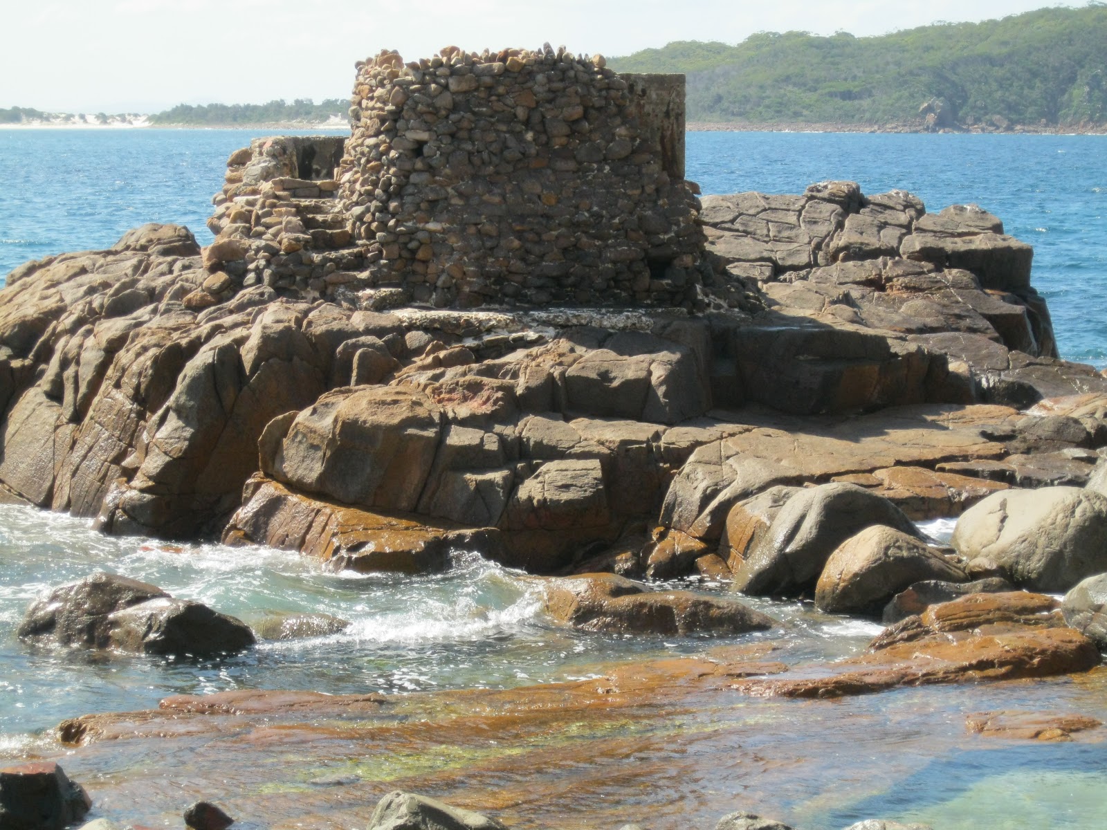
| Remains of a torpedo tube off Tomaree Headland |
 |
| No 2 surf gun (3 Pounder) off Tomaree Headland |
*****************************************************************************
The Nelson Bay, Port Stephens and Newcastle area is rich in early Australian history.
If you are interested in researching Australian history go to our website at :
http://www.historyservices.com.au/convicts.htm
All photos taken October 2012
Blog prepared by Mary McGuinness
http://www.historyservices.com.au/convicts.htm
All photos taken October 2012
Blog prepared by Mary McGuinness
No comments:
Post a Comment